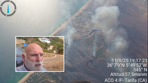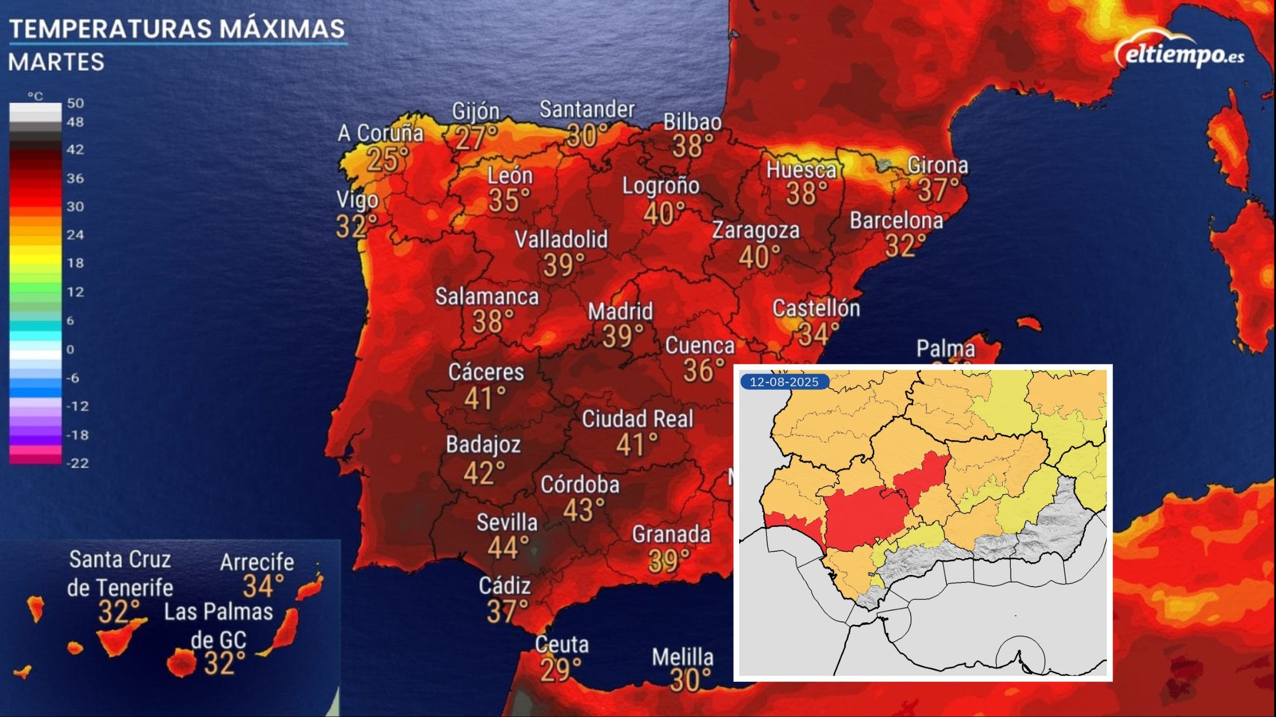
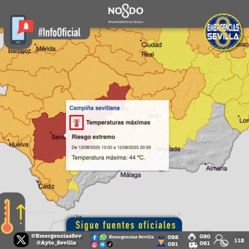
SPAIN’S brutal heatwave has triggered the highest level red weather warnings across parts of western Andalucia today, with thermometers set to hit a scorching 44C in parts of Sevilla and Cordoba provinces.
The countryside areas of both provinces are bracing for the extreme temperatures, whilst the Huelva coast faces its own red alert for readings above 42C.
The red warning, issued by Spain’s meteorological agency Aemet, has seen authorities urge caution when going outside today.
Residents are advised to sip water regularly, opt for light meals, and steer clear of outdoor exertions under the muggy midday sun.
Sevilla’s town hall has rolled out tips like lowering blinds and checking appliance ventilation, while pleading with pet owners to walk their dogs early.
Costa del Sol is set for a milder 27C peak, while Cadiz lingers around 28C and Granada nudges 30C – still warm enough to keep the sunscreen handy.
The warnings come as Monday already saw devastating heat, with El Granado in Huelva recording 44.3C and multiple locations across Badajoz, Sevilla, Teruel and Huelva breaching the 43-44C barrier.
But today’s conditions are expected to be even worse, according to meteorologists.
The interior of Guipúzcoa and Bizkaia in the Basque Country are also under red alerts for temperatures exceeding 40C – unusual for the typically cooler northern regions.
Across Spain’s interior, maximum temperatures will regularly surpass 37-39C, with the Ebro, Tagus and Guadiana river valleys pushing past 40-42C.
READ MORE: Weather warning in Spain: Orange alert for extreme heat as temperatures soar to 41C across Andalucia

The Guadalquivir valley, encompassing much of western Andalucia, faces the most extreme conditions with readings potentially hitting 44C.
Even the Canary Islands cannot escape the furnace-like conditions, with temperatures climbing to 36-38C in mid-level areas and potentially reaching 40C in Gran Canaria’s southern interior, though the archipelago is no longer expected to meet the technical criteria for an official heatwave.
Relief may be temporary. Whilst Wednesday should bring a welcomed drop in temperatures as an Atlantic weather system approaches – particularly benefiting northern regions like Galicia, Asturias and the Basque Country – the respite looks set to be short-lived.
From Thursday onwards, temperatures are forecast to surge once again, potentially extending the punishing heatwave through the entire week and into the weekend.
The renewed heat surge will be driven by a pocket of cold air at altitude west of the peninsula, which paradoxically pushes warm air northwards from Africa.
Night-time offers little sanctuary for heat-weary residents. Minimum temperatures will remain stubbornly above 23-25C across vast swathes of Extremadura, Madrid, Castilla-La Mancha, Andalucia, Murcia and Valencia, making sleep difficult for millions.

The relentless conditions mean temperatures will sit a staggering 8-12C above seasonal averages across much of inland Spain.
Weather experts warn that even if Wednesday’s brief cooling breaks the technical heatwave criteria, Thursday’s return to extreme heat could quickly re-establish the dangerous pattern.
With a strengthening high pressure system set to dominate Spain’s weather through the weekend, combined with intense sunshine heating the air mass, the country faces the prospect of one of its most sustained and severe heatwaves in recent memory.
Click here to read more Andalucia News from The Olive Press.